Hiking in the Alps should be on the bucket list for everyone who is into adventures, wildlife, mountains, and hiking itself. There you will find scenic trails with the highest mountains in Europe and several activities that make backpacking in the Alps fun for every adventure seeker.
The best trails in the Alps are most famously around the countries like Germany, Austria, Italy, France, and Switzerland. From this list, you will find several hikes in the Alps to put on your bucket list.
Disclosure: This article features affiliate links, including Amazon.com. If you decide to buy through one of these links, I’ll earn a small commission at no extra expense to you. For more details, please see my disclosure policy.
1. Schafberg Mountain hike
Recommended by Martina from PlacesofJuma
- Location: Salzburg, Austria
- Difficulty: Moderate
- Accommodation: Im Weissen Rössl
- Distance: 13 km (8.1 mi.)
- Duration: 3h 30min
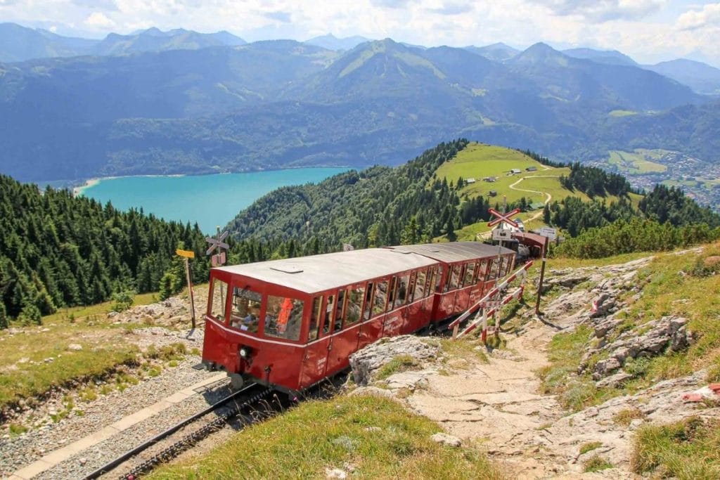
Austria is one of the best places for hiking in the Alps. One of the most beautiful is the hikes up to the famous Schafberg, which is located on the edge of picturesque Lake Wolfgang. The peak is located at 1,732 meters (5,682 ft.) above sea level and can be reached via hiking trail no. 20.
This impressive panoramic hike is not too difficult, I would say moderate, but you should keep in mind that you will have to walk a height difference of 1,188 meters (3,900 ft.). All in all, the entire hike to the top takes 3 hours and 30 minutes. If it is too exhausting, you can cut short at the middle station and take the red nostalgic train up to the mountain.
While hiking, you will always enjoy a magnificent panorama of Lake Wolfgang and the surrounding Alps. At the summit is one of the most beautiful Instagram spots ever: from here you have a breathtaking view of the many glittering lakes in Salzburg and a huge part of Upper Austria.
The hike up the Schafberg is recommended in summer, from May to the end of September. It is best to start your tour in the morning when the weather is still pleasant and cool. The way back is then best done with the red Schafbergbahn. Today, this red train is one of the most famous tourist attractions in the region and a must-see when you go to Salzburg or Upper Austria.
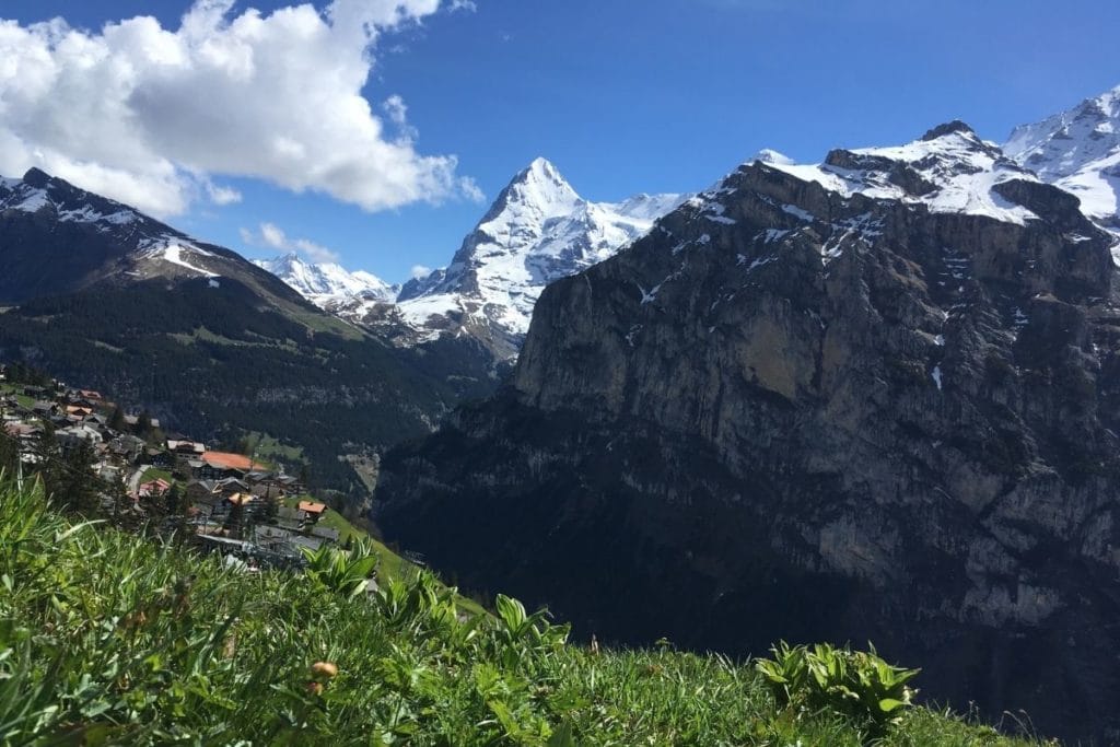
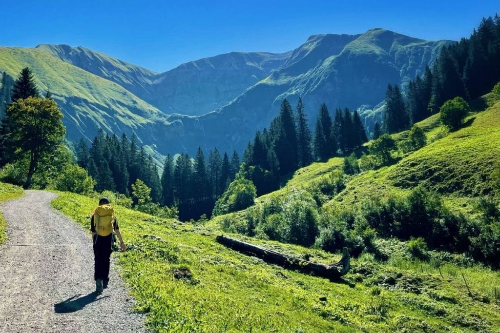
2. Lauterbrunnen valley hikes
Recommended by Mikaela of Voyageur Tripper
- Location: Interlaken-Oberhasli, Switzerland
- Difficulty: Moderate
- Accommodation: Mountain Hostel Gimmelwald
- Distance: 4.8 – 11.3 km (3 – 7 mi.)
- Duration: 1 – 4 hours
Lauterbrunnen Valley offers a network of moderate hiking trails with superb views of the valley and surrounding mountains. There are several towns perched on the side of the mountain – some, like Gimmelwald, are only accessible by foot or gondola. The towns are then connected to one view via well-maintained hiking trails, with some trails veering off to travel by scenic lakes or towering waterfalls.
Due to the interconnected nature of the trails, there isn’t one specific trail there. Instead, there are some common routes and a lot of room for a choose-your-own-adventure route. As long as you have a map and a sense of where you started, you can explore at your leisure.
That said, there are a few notable trails to consider. One of the best trails here is the Northface Trail (7.4 km / 4.6 mi.), leaving from Murren. One feature of the trail is Sprutz Waterfall – the water falls over the end of an outstretched part of the mountain and the hiking trail goes underneath (don’t worry, it’s safe).
Another great trail is the Rotstockhütte – Hotel Sonnenberg trail (11.1 km / 6.9 mi.) which goes to the top of Schilthorn (the highest peak in the vicinity, at 2,964 m / 9,725 ft). You can also take a gondola to the top of the peak, but the hiking trail is free and provides a greater variety of views.
If you plan to do some hiking in the Alps while in Lauterbrunnen, consider staying at the Mountain Hostel in Gimmelwald as it will give you the best access to the trail network. You can also go paragliding through Lauterbrunnen Valley, which departs from the top of one of the hiking trails near Murren.
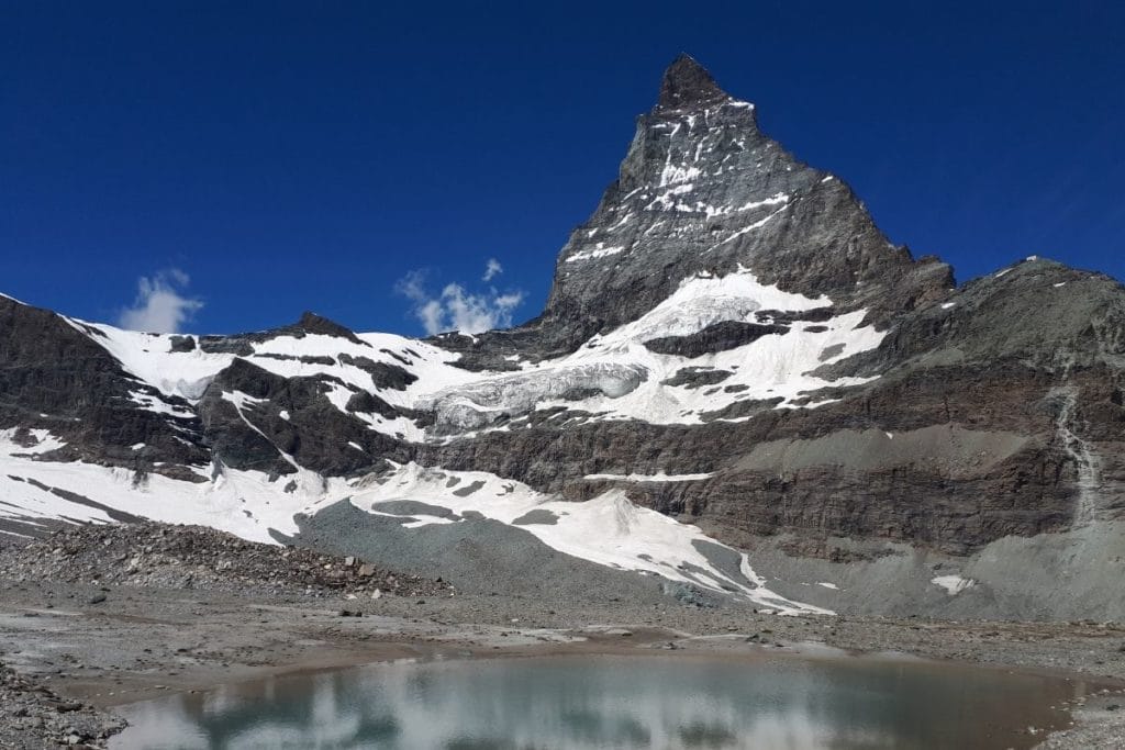
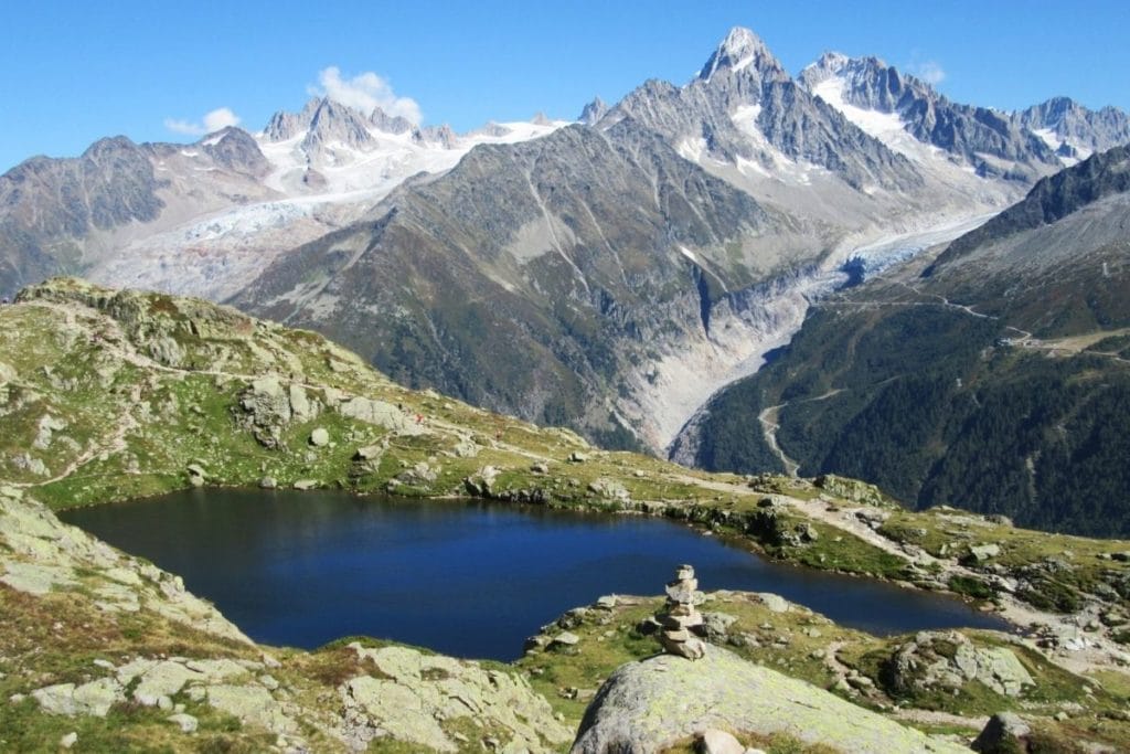
3. Matterhorn Glacier Trail
Recommended by Linda at Hiking the Alps
- Location: Zermatt, Switzerland
- Difficulty: Easy-Moderate
- Accommodation: Hotel Phoenix
- Distance: 6.5 km (4 mi)
- Duration: 2.5 h
The impressive Matterhorn Glacier Trail, passing underneath the world-famous mountain, takes you in a surreal world of ice and stone. It is one of the best day hikes in the Alps!
The starting point for that fantastic hiking experience, on the bottom of the impressive Matterhorn, is the lift station “Trockener Steg”. The Matterhorn is the symbol of Switzerland and with 4,478m (14,691 ft.), it’s one of the highest peaks in the Alps.
From the lift mountain station, at 2,939 m (9,642 ft.), you will find yourself in a moon-like world.
Hiking towards the impressive Matterhorn, you will pass several small glacier lakes. That entire area is leftovers from the Theodul Glacier which retreated in the past 150 years by more than 3 km (1.86 mi.)!
Without wind, you may have the chance to get some awesome Matterhorn reflection shots in the Theodul Glacier lake.
Hiking slowly downhill, you will reach the ice-cold river, on the bottom of the Matterhorn. Follow the icy waters and once reaching the top of a stony little hill, you can already see the beautiful lake Schwarzsee.
Enjoy some great views of the tallest mountain in Switzerland before returning to the village of Zermatt by cable car.
Along the fascinating trail, you will find 23 information panels in different languages, giving you additional information on that surreal moon-like area and the retreating glaciers.
All lift stations are located in the village center of charming Zermatt. Being in Switzerland, be prepared to pay a minimum of CHF 70.00 for your tickets.
The fascinating hike in the Alps takes you across rough terrain, therefore good hiking boots are essential. There is no shade at all during the entire hike, so be sure to bring plenty of water.
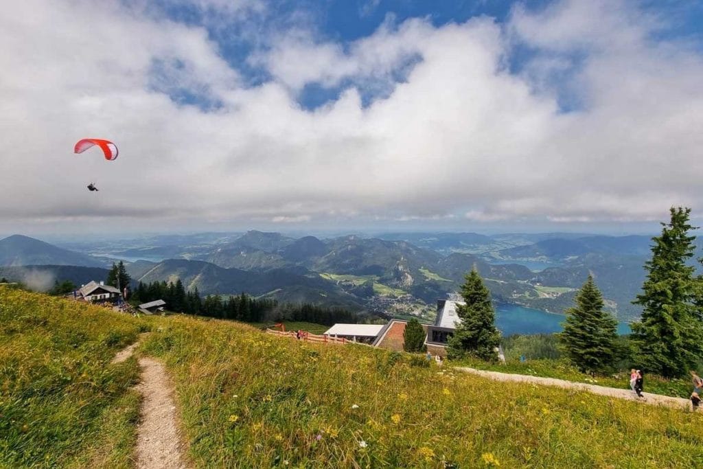
4. St Gilgen hikes
Recommended by Joanna from The World in My Pocket
- Location: Salzburg, Austria
- Difficulty: Easy
- Accommodation: Hotel-Garni Schernthaner
- Distance: 3.1 km (1.9 mi.)
- Duration: 1 – 2h
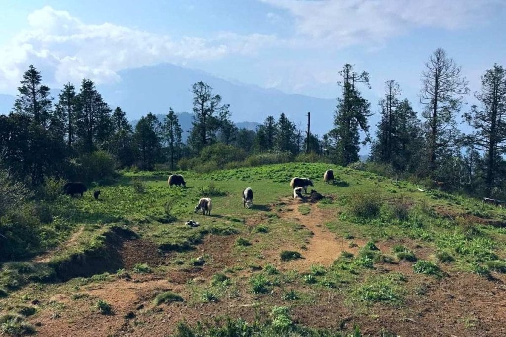
St Gilgen is one of the most charming villages on the shore of Wolfgangsee Lake, in the Salzburg region of Austria. One of the best things to do in St Gilgen is taking the cable car up Zwölferhorn mountain and hiking on one of the trails starting from the station on top. The easiest trail is 3.1 km (1.9 mi.) long and offers spectacular views over the Alpine scenery and the lakes in the area.
The Zwölferhorn trail is circular and is very suitable for the entire family, including buggies. The path is wide and well maintained, with only one rocky portion which can be avoided by going around the cliff.
Along the way, there are different educational points where children can learn about the local geography, wildlife, and even astrology. In different parts of the trail, you will stumble upon cows with large bells around their necks, which are grazing peacefully on the pastures on top of the mountain. They are used to people, but it is recommended not to approach them.
You will find three restaurants serving traditional Austrian Alpine dishes, but they are all close to the cable car station, so plan accordingly. Whilst it is not a long trail, don’t forget to take water with you, and a few snacks if you plan to spend more time taking photos.
This trail is open both in summer and in winter. If you want to stay in the area you can choose one of the hotels in St Gilgen, or the nearby town of Salzburg, which is easily accessible by public transport.
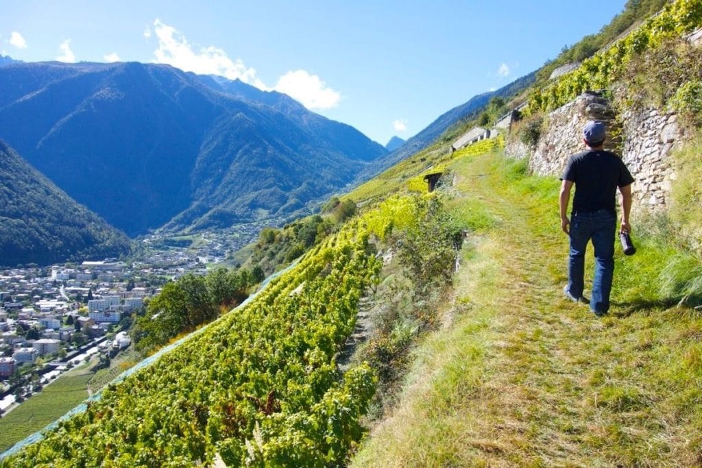
5. Martigny Terrace Vineyard Trail
Recommended by Michelle C. of Intentional Travelers
- Location: Martigny, Switzerland
- Difficulty: Moderately Easy
- Accommodation: Martigny Boutique-Hôtel
- Distance: 7.3 km (4.5 mi.)
- Duration: 2+ hours
Martigny, one of the larger valley towns in the Valais region of Switzerland, is home to beautiful terraced vineyards. The hike in the Alps can begin from Martigny train station for easy access to out-of-town visitors.
From town, walk to the covered bridge and continue through the charming village of La Batiaz on your way up to La Batiaz castle. This renovated 13th-century castle and nearby picnic area overlooks the river and is a destination unto itself if you wish to do a shorter hike.
From the castle, the 6.4 km (4 mi.) hiking trail southwest through the hillside vineyards is not to be missed. Rows of grapes ascend above the city as you hike slightly downhill toward the quaint little hamlet of Plan-Cerisier. Finally, return along the riverwalk at the valley floor.
The total elevation change is about 200 m (650 ft.). Some of the paths are paved, while sections through the vineyards are flat gravel or grass. The trail is not particularly challenging apart from an initial climb so other than good walking shoes, no special equipment is needed.
You can return on foot anywhere in Martigny if staying in town, such as the top-rated Villa de Maître, or take the train if staying elsewhere in the Valais region. If you’re visiting the Swiss Alps, this is a fantastic trail for scenery, history, and easy access to amenities in Martigny.
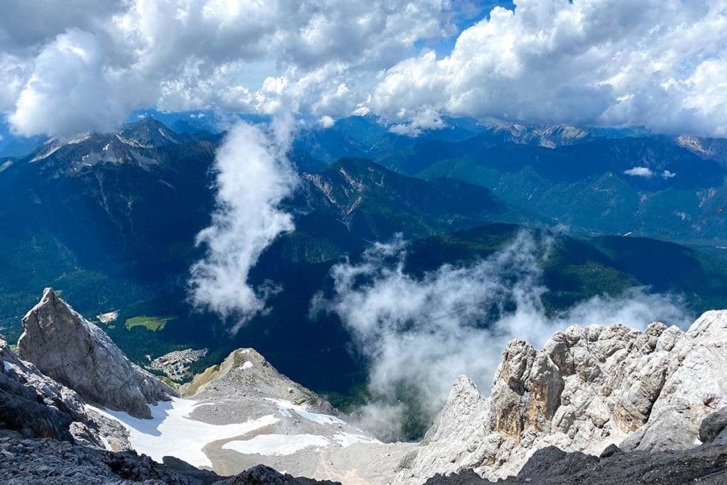
6. Zugspitze hikes
Recommended by Diana from The Globetrotting Detective
- Location: Bavaria, Germany
- Difficulty: Difficult
- Accommodation: Hotel Zugspitze
- Distance: 23 km (14,30 mi.)
- Duration: One way about 10-11 h
There are six hiking routes to reach the highest mountain peak of Germany, Zugspitze: Reintal, Höllentalklamm, Jubiläumsgrat, Kletterroute Eisenzeit, and two more routes including longer Via Ferrata trails which are Gatterl and Stopselzieher.
All of them are quite difficult. You can do the hike in one day or two days. Hiking Zugspitze in one day is both physically and mentally challenging. Hiking in the Alps trail in two days is more relaxing.
Hiking Zugspitze is mainly challenging because of the huge elevation gain, in total ~2200 m (7,220 ft.) Imagine that in one day!
If you choose the Reintal route, the trailhead of the hike is located in Garmisch-Partenkirchen at an altitude of 708 m (2323 ft) and the endpoint is the glorious summit of Zugspitze is at 2,962 m (9,718 ft).
You must start the hike very early so that you reach the top around 2 pm. Zugspitze more often than not gets cloudy after 2-3 pm and the view will probably not be clear later then. You don’t want to miss the mind-blowing vista over Eibsee Lake on the way up and the breathtaking panoramic view from the summit of Zugspitze because of thick clouds.
The trail has a lot of different parts: easy flat routes along rivers, extremely steep parts with rough gravels or huge rocks, parts that are steep and slippery at the same time, and parts with easy Via Ferrata.
You will need a headlamp or a torch if you start the hike very early. You will be grateful for hiking gloves as well. They will protect your hands when scrambling upwards on small rocks and when using the Via Ferrata ropes. You should carry as little as possible in your backpack because the hike is pretty difficult. Instead of carrying a lot of food, on the way, there are epic alpine huts where you can have drinks, snacks, or proper meals.
The best time to hike Zugspitze is at the end of June, July, August, and at the beginning of September. This time the temperature is very pleasant and sunny. Before and after summer there is too much snow on the way.
If would like to hike Zugspitze in two days, you can stay in one of the charming and cool alpine huts while backpacking in the Alps: Partnachalm (983 m / 3225 ft), Reintalangerhütte (1369 m / 4491 ft) Knorhütte (2,052 m / 6732 ft), DAV, Münchner Haus at (2,959 m / 9,708 ft). Whichever you choose, make sure to book well in advance. The Münchner Haus on the top of Zugspitze is generally booked a year in advance. The other huts are easier to book.
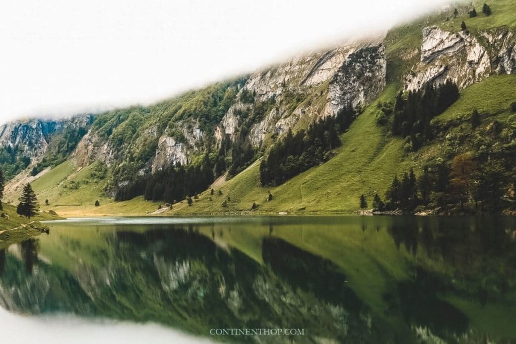
7. Seealpsee hikes
Recommended by Lavina from Continent Hop
- Location: Wasserauen, Switzerland
- Difficulty: Moderately easy to difficult
- Accommodation: Hotel Alpenblick
- Distance: Varies
- Duration: From 3h to multi-day
The Seealpsee hike in the Alps is fun as not only are the views and the surroundings pretty, one can customize it to be as challenging or as easy as they’d like because there are numerous paths one can opt to hike in this dense network in the Alps.
To get to any of the starting points at the base, you need to get the Appenzell railway that’s available from most parts in Switzerland and get down at Wasserauen. Once you’re here you can either choose to start hiking from this point itself or catch the cable car and get off at any of the numerous stops and start your hike from there.
As mentioned, the route network here is quite dense so you could start and end your hike at any location, you can even opt to stay at any of the pretty lodges at the pit stops and spend a few days too. Santis is the highest peak on this route that you can hike to, but other locations worth a visit are Gartenalp, Altmann, and Rotstein.
The exact hike from Wasserauen to other stops is moderately difficult and, depending on the route taken, can get easier or even more challenging. Ideal region while backpacking in the Alps, where the views on every path are stunning and full of lakes, mountains, and forest clusters. The air is the freshest you’ll ever find in Europe!
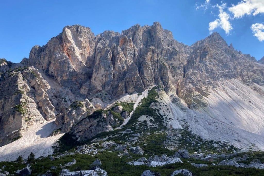
8. Alta Via 1 trek
Recommended by Dean and Laynni from Routinely Nomadic
- Location: Dolomites, Italy
- Difficulty: Moderate
- Accommodation: Steinwandterhof
- Distance: 120 km (74.5 mi.)
- Duration: 8-11 days
Italy’s spectacular Alta Via 1 runs north-south through the heart of the incredible Dolomites. While there are 6 Alta Vias (High Routes), several of the others involve serious via Ferrata (cables and ladders) so the Alta Via 1 is the most accessible, popular, and least technical.
With unbelievable mountain scenery, well-marked routes, and fantastic huts every step of the way, the Alta Via 1 is certainly one of the best long-distance treks in the Alps and all of Europe.
The jagged peaks of the Dolomites provide consistently exceptional scenery, occasionally interspersed with lovely rolling grasslands, reflective alpine lakes, and charming villages. But as amazing as the natural surroundings are on the Alta Via 1, many spots along the way also feature a grim history.
The entire region was hotly contested during World War I and the remnants of those tragic days are apparent in the numerous abandoned bunkers, tunnels, and armaments, especially around Rifugio Lagazuoi, one of the best hikes in Italy.
While it is possible to hike the Alta Via 1 in either direction, most people start backpacking in the Alps route at gorgeous Lago di Braies in the north and hike down to La Pissa bus stop on the Belluno-Agordo highway.
There is usually still snow on the trail until the end of June and the first flurries start arriving in mid-September, leaving a short 2.5-month window to hike one of the very best trails in the Alps.
9. Quattro Sorelle hike
Recommended by Natalie from The Best of Turin
- Location: Bardonecchia, Italy
- Difficulty: Moderate to difficult
- Accommodation: Residence La Tana del Ghiro
- Distance: 18 km (11.2 mi.)
- Duration: 7 h
The Quattro Sorelle trail is located in Bardonecchia, an alpine town in the Piedmont region, Northern Italy. Bardonecchia is one of the best ski resorts near Turin, and it’s packed with activities all year round.
The Quattro Sorella summit is 2,600 meters (8,530 feet) above sea level at the border with France. It’s a hidden gem, only known by local hikers and mountain bikers who like stunning views and a not-so-touristy spot.
The starting point of the trail is Bardonecchia train station, from where you have to walk through the tiny and picturesque town to the Quattro Sorelle peak. It’s a moderated hiking trail with an altitude gain of 1,400 meters (4,600 feet). You must wear proper shoes and have water and food, as there is no place to stop or shop.
You can start the trail by following the signs to Poggio Tre Croche, a viewpoint overlooking Bardonecchia. This first leg to Poggio Tre Croche is quite steep (elevation gain of 800 m / 2600 ft.), but it’s easy to walk as it has marked roads, and it’s all under shade.
From Poggio Tre Croche, the trail is all gravel without shade or protection. It’s a well-marketed trail, but you need to be careful and protect yourself from the sun and wind.
The last part of the path is the most challenging. To reach the summit, you will have to hold on to ropes fixed on the rocks. It’s a vertical path, and you must have a bit of experience to climb it.
It’s a scenic hike in the Alps, where you can admire the gorgeous Italian and French Alps. The view from the summit is breathtaking, so is the way up there.
It tooks about 7h to complete the whole 18 km (11.2 mi.) circle trail, starting and finishing at the train station. In Autumn, the temperature is perfect, not too hot, and not too windy. However, the midday sun could be a big challenge. So don’t forget your hat, sunscreen, and sunglasses.
Check out Residence La Tana del Ghiro apartments if you plan to stay in Bardonecchia. Another option is to stay in Turin, the region’s capital and the closest city to have an international airport and a high-speed train station. The train from Turin to Bardonecchia takes only 1hour and a half.
10. Allgäuer Alps hike
Recommended by Morgan from Crave the Planet
- Location: Oberstdorf, Germany
- Difficulty: Easy
- Accommodation: Explorer Hotel Oberstdorf
- Distance: 21 km (13 mi.)
- Duration: 5 h
Are you dreaming of doing one of the famous long-distance hikes over the Alps but want to test the waters first? This hike in the Alps can be done as a day hike, or more interestingly as section 2 of the Allgäuer Alps Dog-Friendly Hotel to Hotel Hike.
It is a very well-maintained and idyllic mountain trail passing over the 2,259 m (7,400 ft.) high Höfats peak. The last 7 km will delight you and your kids as it can be done using a mountain scooter. You’ll fly down a smooth paved path into the town of Oberstdorf to finish.
Starting at the Mountain Hostel Valley Spielmannsau, you’ll pass by several mountain huts serving very local cheeses and even walk through the fields of Alpine cows with bells tinkling serenely on their necks.
You’ll also see marmots and foxes on this summer trail. The best time to hike would be mid-June through late September.
It is at the base of the famous E4 long-distance path in the secluded Allgäuer Alps in Bavaria, Germany. This hike is strenuous but with the fun scooter ride at the end, cute cows, and plenty of stops for food, it is possible for children ages 8 and up to enjoy.
11. Lac Blanc hike
Recommended by Lauren from The Planet Edit
- Location: Chamonix, France
- Difficulty: Difficult
- Accommodation: Chalet Hôtel Le Prieuré
- Distance: 11 km (7 mi.)
- Duration: 5 – 6 h
Lac Blanc is renowned as one of the best lakes in the French Alps, thanks to its exceptional views over the famous Mont Blanc and its surrounding peaks. As you can imagine, hiking to Lac Blanc is a favorite while backpacking in the Alps and around the region.
There are a few hiking trails that lead to Lac Blanc, but this beautiful circular route will keep you away from the cable cars and the crowds.
The trail begins and ends just outside of Argentière in Tré-le-Champ, where’s a free car park right next to the start of the trail. The trail can also be accessed by public transport: there is a TER bus that runs from Chamonix-Mont-Blanc to Montroc le Planet, which is a 15-minute walk from the start of the trail.
It’s a challenging hike: there are lots of steep sections and you will also need to climb up ladders that are fixed to the side of the mountain. A good level of fitness, a bit of a head for heights, and sturdy footwear are essential.
However, your efforts will be greatly rewarded with the soaring scenery of the Mont Blanc Massif and Aiguilles Rouges. You’ll see the Aiguillette d’Argentière – a striking rock formation loved by climbers – the Lacs des Cheserys, and of course, Lac Blanc itself.
If you’re lucky, you might also spot wildlife such as ibex, chamois, marmots, and golden eagles, who are all frequently spotted on the trail.
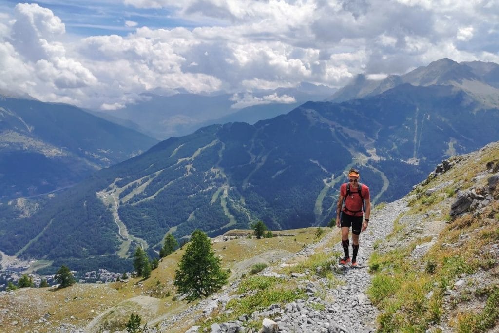
12. Sella-Herbetet Traverse hike
Recommended by Rai of A Rai of Light
- Location: Gran Paradiso, Italy
- Difficulty: Difficult
- Accommodation: Hotel Lo Fleye
- Distance: 20.5 km (12.7 mi.)
- Duration: 1-2 days
Sella-Herbetet Traverse, found in the Graian Alps of Italy, is a challenging route along part of the Gran Paradiso mountain range. Beginning in the small village of Valnontey, it is easy to arrive here from any major city in the country by following the directions to Valle di Cogne or Valsavarenche.
Even though this trail is open throughout the year, the best time for a visit is during the warm months of May to October. The hike, over a distance of 20.5 km (12.7 mi.), goes through the Parco Nazionale del Gran Paradiso to Sella Refuge, a historic hunting lodge of King Vittorio Emanuele II.
From here the trail extends south towards Casolari dell’Herbetet, with a length of chain for protection. This region is a sanctuary for the travel lover with amazing views of the glaciers, alpine lakes, valleys, and a handful of the highest mountains in the country.
Wildlife lovers will also enjoy seeing the herds of ibex and chamois throughout the trail. The ascent is 1,180 m (3,871 ft.) and the return is a downhill trek to the village from the Casolari.
This long but rewarding trail can be completed in under 8 hours, however, it is recommended to split this up over two days by spending the night at one of the huts along the way. It is essential to confirm that the weather is clear for the entire day before attempting this hike in the Alps as the narrow paths can become dangerous during periods of limited visibility.
Conclusion
Here was the list of the best hikes in the Alps. Hopefully, you found some new walks, hikes, or treks for your bucket list. Go and hike on the top of Europe and enjoy the scenery of the Alps magnificent landscape.
PIN IT
Recent posts about Hiking: